Typhoons are among the most powerful weather systems on Earth. Their enormous clouds stretch across vast areas of the ocean, carrying strong winds, heavy rain, and immense energy. For people who live in regions where these storms occur, typhoons can be both familiar and frightening. Every year, communities prepare for the possibility of severe weather that can disrupt daily life, damage property, and reshape landscapes. Despite their destructive reputation, typhoons are also remarkable natural phenomena that reveal how interconnected the atmosphere and oceans truly are.
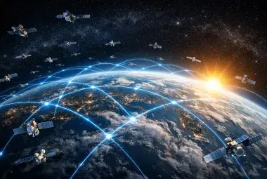
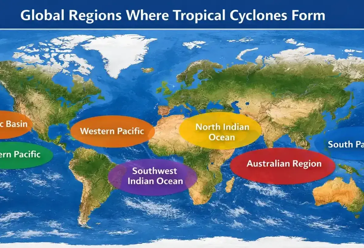
A typhoon is a type of tropical cyclone that forms over warm waters in the western Pacific Ocean. Similar storms exist in other parts of the world but are known by different names. Regardless of what they are called, these systems follow many of the same scientific principles. Warm ocean temperatures provide fuel, rising air creates powerful circulation, and atmospheric conditions determine whether a storm strengthens or weakens. Scientists continuously monitor these storms using satellites, aircraft, weather stations, and computer models to better understand their behavior.
Typhoons have influenced human history for centuries. They have affected trade routes, shaped coastal communities, and inspired stories that have been passed down through generations. Advances in forecasting technology now allow people to receive warnings earlier than ever before, helping reduce the loss of life when storms approach populated areas. Even so, typhoons remain unpredictable in many ways, reminding us that nature still possesses forces beyond complete human control.
Understanding typhoons is important not only for those who live in storm prone regions but also for anyone interested in weather and the natural world. These powerful systems demonstrate how energy moves across our planet and how small changes in environmental conditions can produce dramatic effects.
1. Typhoons and Hurricanes Are the Same Type of Storm
Many people believe typhoons and hurricanes are completely different weather events. In reality, they are the same type of storm. The primary difference is the region where they form. Storms that develop in the western Pacific Ocean are called typhoons, while those that form in the Atlantic Ocean and the eastern Pacific Ocean are called hurricanes. Meteorologists classify both as tropical cyclones, which are rotating storm systems powered by warm ocean water.
The naming difference developed over time as people in various parts of the world created regional terms for the storms they experienced. Although the names differ, the scientific processes behind them are nearly identical. Both require warm ocean temperatures, moist air, and atmospheric conditions that allow thunderstorms to organize into a rotating system. As warm air rises from the ocean surface, more air rushes in to replace it, creating circulation that can eventually become a powerful storm.
Typhoons can reach incredible strength. Some have produced winds exceeding 300 kilometers per hour, making them capable of causing widespread damage. Their heavy rainfall can trigger flooding and landslides, especially in mountainous regions. Coastal areas may also experience storm surges, which occur when strong winds push seawater inland.
Understanding that typhoons and hurricanes are fundamentally the same helps scientists compare storms across different oceans. Researchers study storm behavior globally to improve forecasting and disaster preparedness. Data collected from one region can often help experts better understand storms in another.
The next time you hear about a hurricane in the Atlantic or a typhoon in the Pacific, remember that they belong to the same family of storms. The difference lies mainly in geography rather than in how the storm itself functions. This shared identity highlights the universal forces of nature that shape weather patterns around the world.
Image
2. Warm Ocean Water Is the Fuel That Powers Typhoons
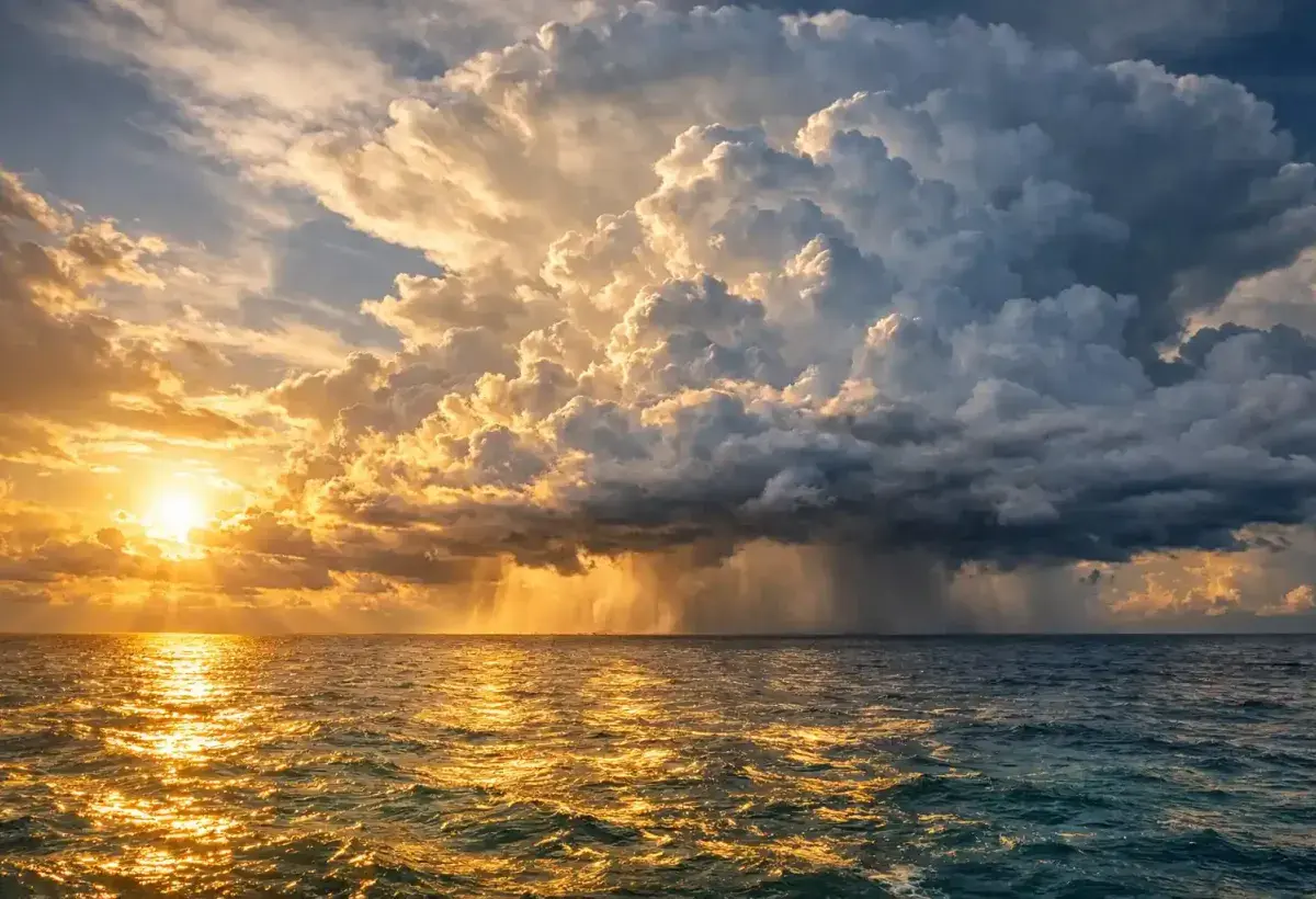
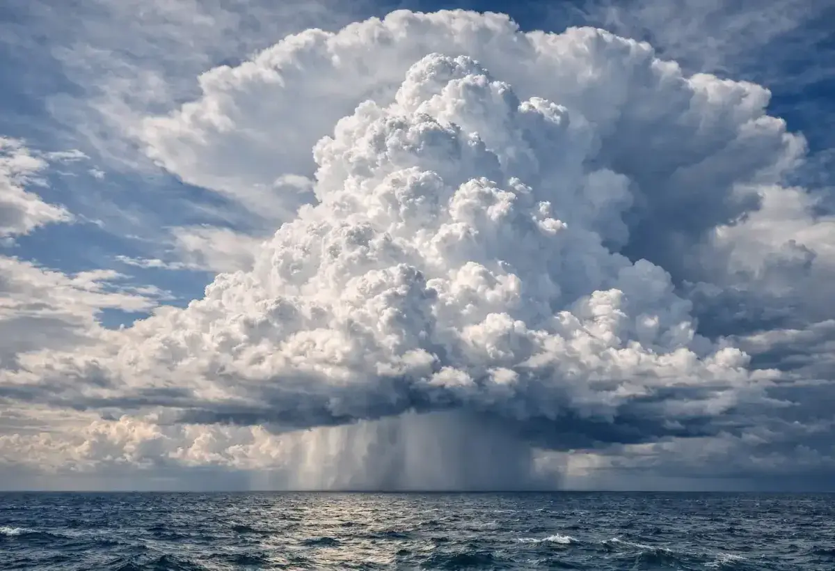
Typhoons owe their existence to warm ocean water. Without sufficiently warm seas, these storms would struggle to form or survive. Most typhoons develop when ocean surface temperatures reach at least 26.5 degrees Celsius. Warm water causes large amounts of moisture to evaporate into the atmosphere, providing the energy needed for storm development.
As moist air rises, it cools and condenses into clouds. This process releases heat into the atmosphere. The released heat acts like fuel, helping the storm grow stronger. The more warm water available beneath the storm, the more energy it can potentially absorb. This is one reason why some typhoons rapidly intensify over favorable ocean conditions.
Scientists often compare typhoons to giant heat engines. They draw energy from warm ocean surfaces and convert that energy into powerful winds and heavy rainfall. This process can continue for days as long as environmental conditions remain supportive. When a typhoon moves over cooler water or makes landfall, its energy source becomes limited, causing the storm to weaken.
Ocean temperatures vary throughout the year, which helps explain why typhoon seasons are more active during certain months. Seasonal weather patterns influence where warm water accumulates and how atmospheric conditions develop. These factors can affect the number of storms that form as well as their potential intensity.
Researchers closely monitor ocean temperatures because they are among the most important indicators of storm development. Satellite technology allows scientists to observe vast areas of the ocean and identify regions where conditions may favor tropical cyclone formation. These observations contribute to weather forecasts and early warning systems.
The relationship between warm oceans and typhoons demonstrates how interconnected Earth's systems are. A change in ocean temperature can influence atmospheric conditions thousands of kilometers away, creating weather events that affect millions of people.
Image
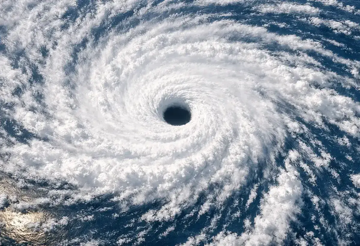
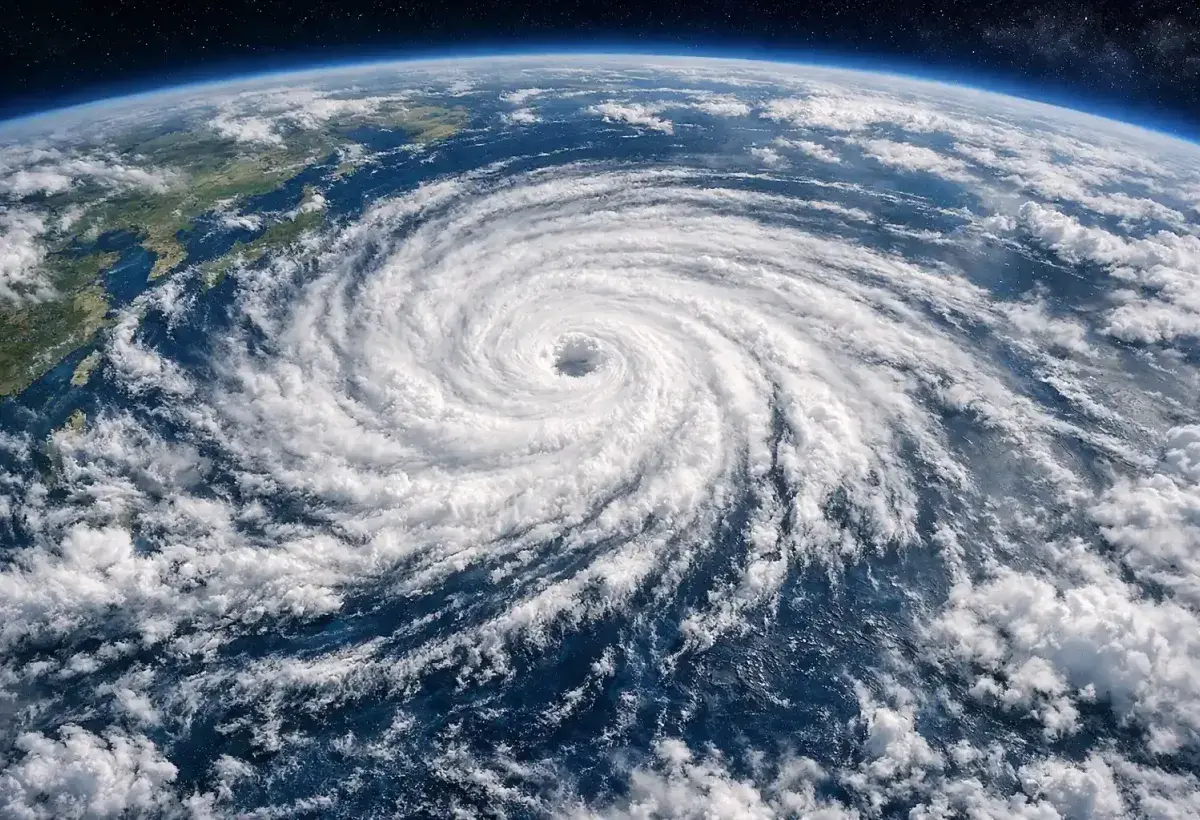
3. The Eye of a Typhoon Can Be Surprisingly Calm
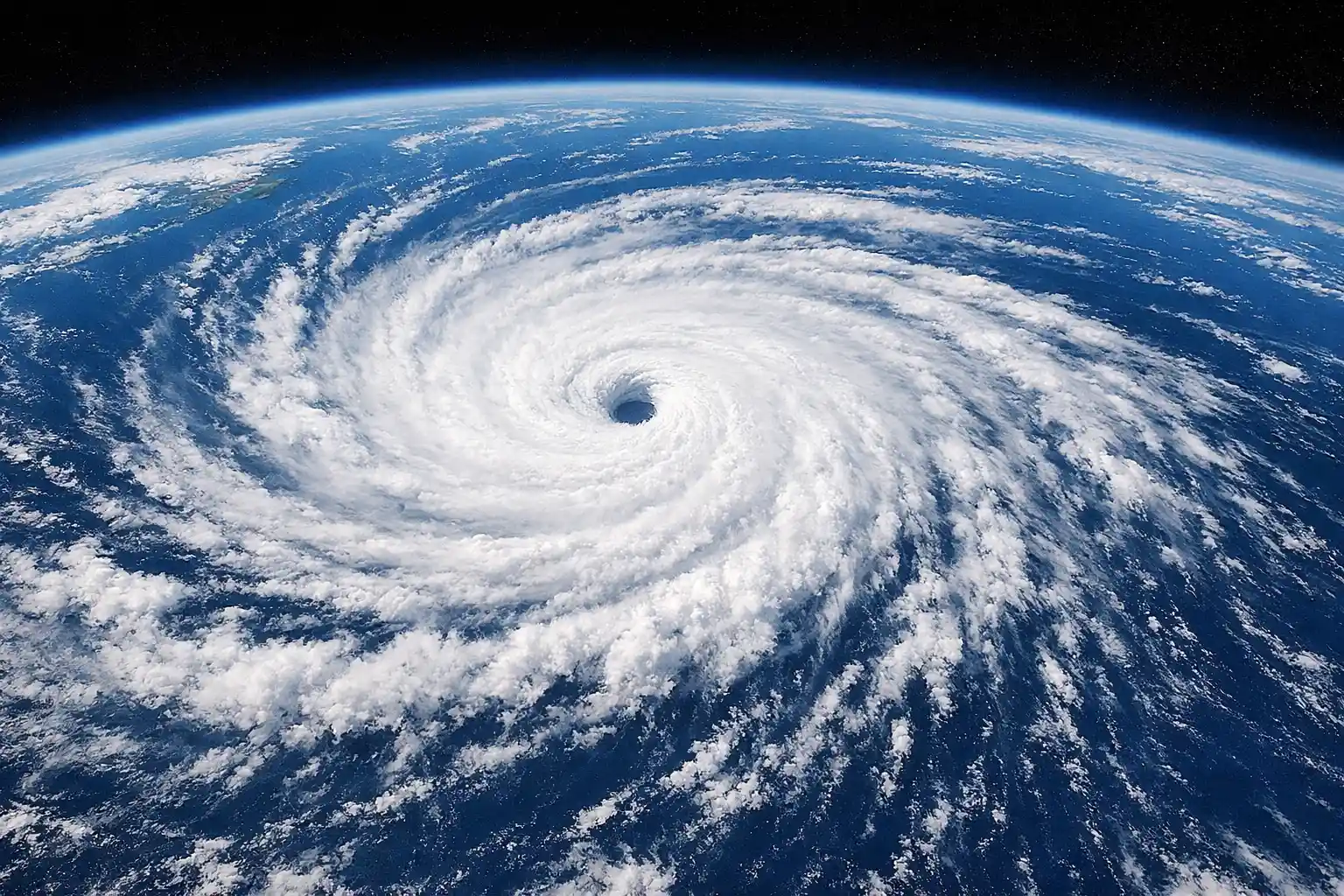
One of the most fascinating features of a typhoon is its eye. From satellite images, the eye often appears as a circular opening in the middle of the storm. While powerful winds rage around it, conditions inside the eye can be surprisingly calm.
The eye forms when air sinks toward the center of the storm. As the air descends, cloud formation decreases, creating a relatively clear area. Depending on the size and strength of the storm, the eye may range from only a few kilometers wide to several dozen kilometers across.
People who experience the passage of a typhoon may notice a sudden change when the eye arrives. Heavy rain can stop, winds may weaken dramatically, and sunlight might even become visible. This calm period can create a false sense of safety. The storm is not over. The opposite side of the eyewall is still approaching and often brings powerful winds from a different direction.
Surrounding the eye is the eyewall, which is usually the most dangerous part of the storm. The eyewall contains intense thunderstorms, powerful winds, and heavy rainfall. Meteorologists pay close attention to changes in the eyewall because they can reveal whether a storm is strengthening or weakening.
The eye is one of the reasons satellite imagery is so useful. A clearly defined eye often indicates a well organized and potentially strong typhoon. Scientists use satellite observations to monitor changes in eye structure and track storm development over time.
Despite its calm appearance, the eye remains part of a highly dangerous weather system. Understanding its behavior helps emergency planners and weather experts communicate risks more effectively. The contrast between the peaceful center and the violent surroundings makes the eye one of the most remarkable features found in nature.
Image
4. Typhoons Can Release More Energy Than Many Human Activities Combined
The amount of energy contained within a typhoon is difficult to imagine. These storms draw power from warm oceans and convert it into wind, rainfall, and atmospheric motion on a massive scale. Scientists estimate that a mature tropical cyclone can release energy comparable to many times the world's daily electricity production.
A large portion of this energy comes from the condensation of water vapor. As moist air rises and forms clouds, heat is released into the atmosphere. This heat helps sustain the storm and drives further circulation. The process continues as long as the storm has access to warm, moisture rich air.
Although the total energy is enormous, it is spread across a vast area. This means that people experience the storm through its local effects such as strong winds, flooding, and heavy rain rather than through a single concentrated burst of power. Even so, the cumulative impact can be tremendous.
The tremendous energy of typhoons demonstrates the power of natural systems. Oceans store large amounts of heat from the sun, and tropical cyclones serve as one way that energy is redistributed through the atmosphere. In this sense, typhoons play a role in Earth's broader climate system.
Scientists continue studying storm energy to improve forecasting models and understand how changing environmental conditions may influence future storms. By measuring ocean temperatures, atmospheric moisture, and wind patterns, researchers gain insights into the factors that contribute to storm intensity.
The scale of a typhoon's energy reminds us that weather is more than a local event. It is part of a planetary system driven by interactions between the sun, oceans, and atmosphere. Typhoons are among the clearest examples of these powerful natural processes in action.
Image
5. Typhoons Help Redistribute Heat Around the Planet
Although typhoons are often viewed only as destructive storms, they also perform an important function within Earth's climate system. One of their roles is helping redistribute heat from tropical regions toward higher latitudes. This movement contributes to balancing temperature differences across the planet.
Tropical oceans receive large amounts of solar energy throughout the year. Without mechanisms to transport some of this heat elsewhere, temperature differences between regions would become even more extreme. Typhoons act as part of the atmosphere's natural circulation system by moving warm air, moisture, and energy over large distances.
As a typhoon develops, it draws warm, moist air upward and outward. This process transfers energy into the atmosphere and can influence weather patterns far beyond the storm's immediate location. Moisture carried by the storm may eventually contribute to rainfall in regions hundreds or even thousands of kilometers away.
Scientists study these interactions because they reveal how connected global weather systems truly are. A storm forming over the western Pacific can influence atmospheric conditions across broad areas of Asia and the Pacific region. Understanding these connections improves long term weather and climate research.
Of course, the beneficial role of heat redistribution does not reduce the dangers associated with typhoons. Communities in a storm's path can still experience severe impacts. However, recognizing the broader environmental function of these storms provides a more complete picture of their place in nature.
Typhoons demonstrate that natural phenomena often have multiple roles. They can be both destructive and essential components of Earth's climate processes. By moving heat and moisture across the atmosphere, they help maintain the dynamic balance that shapes weather around the world.
Image
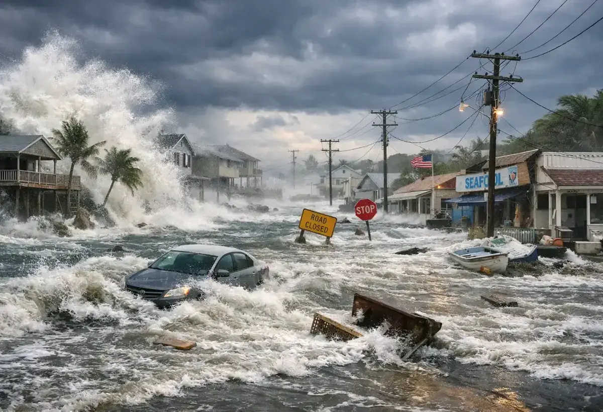
6. Typhoons Can Produce Dangerous Storm Surges
When most people think about typhoons, they often imagine powerful winds and heavy rain. However, one of the deadliest hazards associated with these storms is storm surge. A storm surge occurs when strong winds push large amounts of seawater toward the coast, causing water levels to rise well above normal tides. In severe cases, entire coastal communities can become flooded within a short period of time.
Storm surges are especially dangerous because they can arrive rapidly and carry immense force. Water moving inland can damage homes, roads, bridges, and other infrastructure. Even a relatively small rise in sea level can have significant consequences when combined with large waves and strong currents. The danger increases further when a storm surge occurs during high tide, creating even greater flooding potential.
The shape of the coastline also influences the severity of a storm surge. Bays, inlets, and shallow coastal areas can funnel water into smaller spaces, causing water levels to rise higher than they might along a more open coast. This means that some locations are naturally more vulnerable than others.
Scientists and emergency planners closely monitor storm surges because they often account for a large portion of typhoon related fatalities. Modern forecasting systems use computer models, satellite observations, and ocean measurements to estimate how much water may be pushed ashore. These forecasts help authorities issue evacuation orders and prepare emergency responses before the storm arrives.
Public awareness plays a crucial role in reducing risk. Many people underestimate the power of moving water, focusing primarily on wind speed rather than coastal flooding. Yet water is often the force that causes the greatest destruction during a major storm. Understanding storm surge dangers helps communities make informed decisions and take warnings seriously.
As coastal populations continue to grow, preparing for storm surges becomes increasingly important. These powerful walls of water serve as a reminder that the ocean can become one of the most dangerous aspects of a typhoon when conditions align.
Image
7. Some Typhoons Grow Larger Than Entire Countries
Typhoons are not only powerful but also remarkably large. While news reports often focus on wind speed, the physical size of a storm can be just as important. Some typhoons span hundreds of kilometers, covering areas larger than many countries. Their cloud systems can stretch across vast sections of the ocean, affecting weather conditions over enormous regions.
A larger storm does not always mean stronger winds at the center, but it does mean that more locations may experience rain, wind, and rough seas. Communities far from the storm's eye can still feel significant effects. Fishermen, shipping companies, and coastal residents often need to monitor these storms long before they approach land.
The size of a typhoon depends on various atmospheric conditions. Wind patterns, ocean temperatures, humidity levels, and interactions with surrounding weather systems all influence how large a storm becomes. Some storms remain compact and intense, while others expand into sprawling systems that affect multiple regions simultaneously.
Satellite technology has revolutionized our understanding of storm size. Modern satellites provide detailed images that reveal cloud structure, rainfall patterns, and storm expansion. Meteorologists can track changes in storm dimensions and use that information to improve forecasts.
Large typhoons often generate widespread ocean swells that travel far beyond the storm itself. These swells can create hazardous conditions for ships and coastal areas even when skies remain clear. This demonstrates how the influence of a storm extends well beyond the visible clouds.
The enormous size of some typhoons highlights the scale of Earth's weather systems. Looking at satellite images of these storms can be humbling, as they reveal atmospheric processes operating across distances that are difficult to comprehend from the ground. These giant storms remind us that weather is not merely a local phenomenon but part of a vast interconnected system.
Image
8. Typhoon Names Follow Organized International Lists
Many people are surprised to learn that typhoon names are chosen from carefully maintained lists rather than being invented as storms appear. International meteorological organizations work together to create naming systems that make communication easier and reduce confusion during severe weather events.
Before formal naming systems existed, tracking multiple storms could be difficult. If two storms occurred at the same time, misunderstandings could arise between forecasters, governments, and the public. Assigning names made it easier to identify specific storms and communicate warnings clearly.
In the western Pacific region, names are contributed by various countries and territories. These names often reflect cultural traditions, animals, plants, natural features, or meaningful words from participating nations. This approach creates a diverse collection of names that represents the many communities affected by typhoons.
When a particularly destructive typhoon occurs, its name may be retired from future use. This practice helps avoid confusion and acknowledges the significance of storms that caused major loss of life or extensive damage. A replacement name is then added to the list.
The naming process serves practical purposes beyond convenience. During emergencies, clear communication can save lives. A memorable storm name allows people to quickly recognize forecasts, warnings, and evacuation information. It also helps researchers maintain historical records for future study.
Over time, certain typhoon names become part of public memory because of the events associated with them. These names can evoke stories of resilience, recovery, and community response. The naming system demonstrates how science, communication, and public safety work together to manage one of nature's most powerful forces.
Image
9. Modern Technology Has Improved Typhoon Forecasting
Centuries ago, people often had little warning before a powerful storm arrived. Today, advances in technology allow meteorologists to monitor typhoons with far greater accuracy. While forecasting is not perfect, modern tools have dramatically improved the ability to predict storm paths, intensity, and potential impacts.
Satellites play a central role in storm monitoring. Orbiting high above Earth, they provide continuous images of cloud formations, ocean temperatures, and atmospheric conditions. These observations help scientists identify developing storms and track their movement across the ocean.
Weather radar systems provide additional information as storms approach land. Radar can reveal rainfall intensity, storm structure, and changes occurring within the system. Combined with satellite data, radar helps forecasters create more detailed warnings.
Computer models are another essential forecasting tool. These models process enormous amounts of atmospheric and oceanic data to simulate future storm behavior. Meteorologists compare multiple model outputs and use their expertise to develop forecasts. While uncertainties remain, forecast accuracy has improved significantly over recent decades.
Aircraft missions also contribute valuable information in some regions. Specially equipped aircraft fly into storms to collect data on wind speed, air pressure, temperature, and humidity. These measurements improve forecasting models and provide insights into storm structure.
The benefits of improved forecasting extend beyond science. Earlier warnings allow communities to prepare emergency supplies, secure property, and evacuate vulnerable areas when necessary. Governments can position resources in advance and coordinate disaster response efforts more effectively.
Technology continues to evolve, offering the possibility of even better forecasts in the future. As scientists gain a deeper understanding of storm behavior, communities around the world become better equipped to face the challenges posed by typhoons.
Image
10. Typhoons Have Shaped Human History and Communities
Typhoons are not merely weather events. Throughout history, they have influenced cultures, economies, transportation networks, and settlement patterns. Coastal communities across Asia and the Pacific have spent generations adapting to the risks posed by these powerful storms.
In many regions, traditional architecture evolved to withstand strong winds and heavy rainfall. Communities developed building techniques, agricultural practices, and emergency preparations based on lessons learned from past storms. These adaptations reflect the resilience and ingenuity of people living in typhoon prone areas.
Typhoons have also affected trade and exploration. Historical shipping routes often considered seasonal storm patterns, and sailors learned to respect the dangers posed by tropical cyclones. In some cases, major storms altered the outcomes of important historical events by disrupting travel and communication.
Modern societies continue to adapt. Engineers design stronger infrastructure, governments improve disaster planning, and researchers study ways to reduce future risks. Public education campaigns help people understand evacuation procedures and emergency preparedness.
Despite the challenges they create, typhoons have also strengthened communities. Recovery efforts often bring people together, encouraging cooperation and mutual support. Stories of courage, generosity, and perseverance frequently emerge in the aftermath of major storms.
The historical influence of typhoons demonstrates how natural forces shape human experiences. They have affected where people live, how they build, and how they prepare for uncertainty. Understanding this relationship helps us appreciate both the power of nature and the resilience of the communities that face it.
Image

Typhoons are among the most impressive and powerful weather systems found on Earth. They combine immense energy, vast size, and complex atmospheric processes into storms that can influence entire regions. From the warm ocean waters that fuel their development to the calm eyes hidden within their centers, typhoons reveal the remarkable dynamics of our planet's climate and weather systems.
Typhoons are part of Earth's natural processes, helping move heat and moisture around the globe while demonstrating the close relationship between the oceans and atmosphere. At the same time, they present significant challenges for communities that lie in their path. Strong winds, heavy rain, flooding, and storm surges can affect millions of people and reshape landscapes in a matter of hours.
Scientific advances have greatly improved our understanding of these storms. Satellites, radar systems, computer models, and international cooperation allow forecasters to provide earlier and more accurate warnings than ever before. These improvements help save lives and reduce damage by giving people more time to prepare.
Even with modern technology, typhoons continue to command respect. Their power reminds us that nature operates on scales far beyond everyday human experience. Each storm offers valuable lessons about resilience, preparation, and the importance of understanding the environment around us.
As research continues and forecasting methods improve, humanity's ability to live alongside these powerful storms will continue to grow. Yet the awe inspired by a massive typhoon swirling across the ocean is unlikely to fade. These extraordinary weather systems remain one of the clearest examples of nature's strength, complexity, and enduring influence on life across the planet.
Image